Beneath the glass towers of downtown Toronto lies a second city that most people pass through without fully understanding its scale. The PATH is often described as an underground shopping network, but that description barely captures what it really is. It functions as a commuter route, a retail system, a weather shield, and one of the largest pedestrian networks in the world.
Stretching more than 30 kilometres through the downtown core, the PATH connects office towers, transit stations, hotels, and major attractions into a continuous indoor environment. Tens of thousands of people use it every day. It is one of the most unusual pieces of urban infrastructure in Canada because it operates as a hidden layer beneath the street grid.
The most surprising part is that it was never designed as a single system. It grew slowly over time, building by building.
A Network That Began With a Single Tunnel
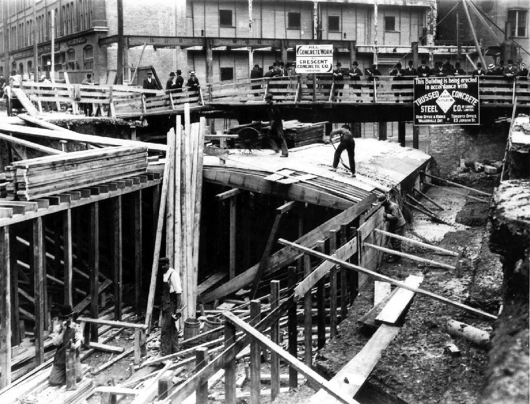
The PATH began in 1900 when the T. Eaton Company built a simple underground tunnel linking its main store on Yonge Street to a nearby annex. What started as a practical retail connection became the foundation for something much larger.
In the decades that followed, more underground passages appeared across downtown Toronto. One of the earliest was a connection between Union Station and the Royal York Hotel built in 1927. These early tunnels were not part of a coordinated plan. They were built to solve specific problems such as weather exposure, congestion, and the need for easier movement between important buildings.
This early experimentation showed that downtown Toronto could function below street level as well as above it.
Growth Without a Master Plan
The system expanded rapidly after the Second World War. Toronto’s financial core was developing quickly and pedestrian traffic increased significantly. Developers began connecting new buildings to existing underground corridors as a matter of convenience and design efficiency.
Instead of being built as a single public infrastructure project, the PATH grew through private development decisions. Each new extension was added to serve a specific building rather than the system as a whole. Over time, these individual connections formed a large underground network.
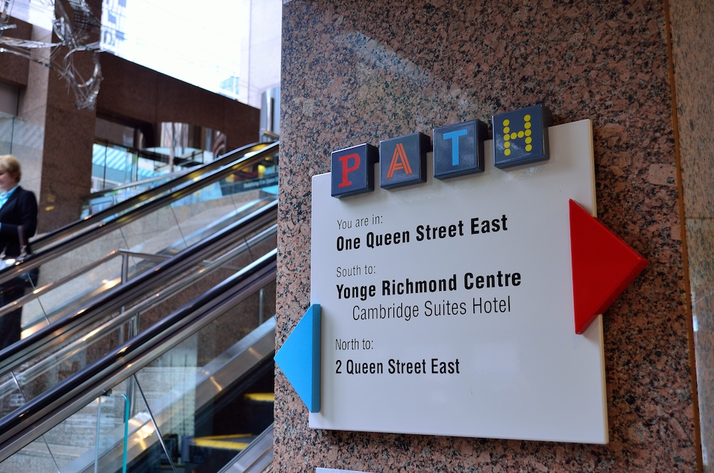
By the late twentieth century, the system had become so extensive that the City of Toronto stepped in to coordinate signage and navigation standards. This helped bring some order to what had become a fragmented but functional underground city.
A City Beneath the City
Today the PATH connects more than 70 buildings in downtown Toronto. These include office towers, hotels, shopping centres, transit stations, and entertainment venues. It links Union Station, the Eaton Centre, Scotiabank Arena, and much of the Financial District.
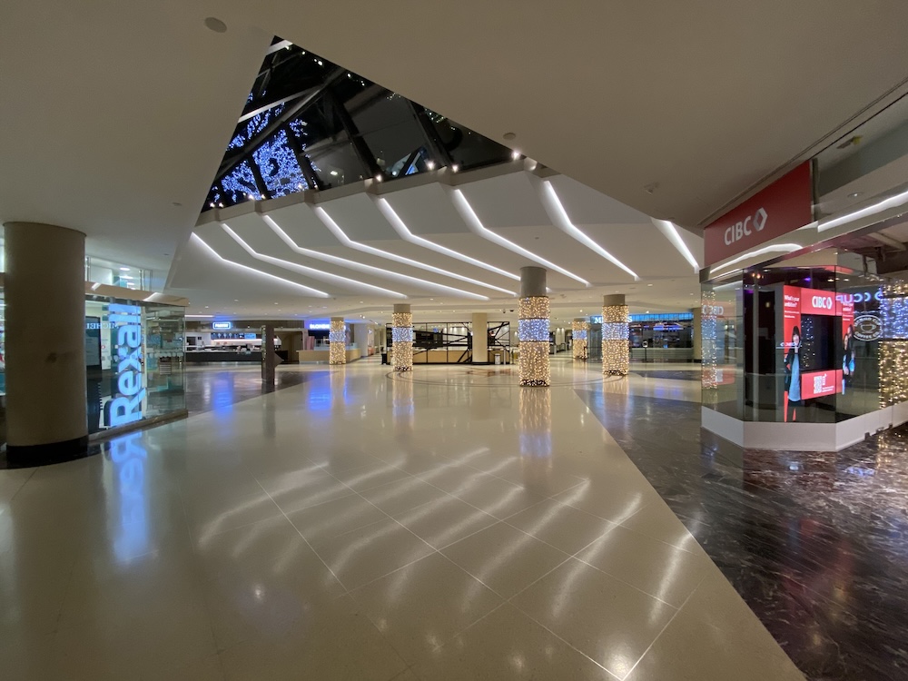
The system includes more than 30 kilometres of walkways, over 1,200 shops and services, and handles hundreds of thousands of users on busy weekdays. It is one of the largest underground pedestrian networks in the world.
At street level Toronto is defined by traffic, sidewalks, and towers. Below ground it becomes a network of corridors, escalators, signage, and retail spaces.
Built for Weather and Convenience
Toronto’s climate played a major role in the growth of the PATH. Harsh winters and hot summers made enclosed walkways attractive for commuters who needed to move between buildings without exposure to the weather.
For many downtown workers the PATH is not a destination. It is simply the fastest way to move between office towers, transit stations, and lunch spots.
This convenience helped drive its expansion but also created a system that is not always easy to navigate.
Why the PATH Feels Like a Maze
Despite its size, the PATH is often confusing for new users. This is largely because it was not designed as a single coordinated system. It developed through separate private projects over many decades.
Different sections were built at different times and by different developers. This means that corridors change style and layout as you move through the network. Some sections pass through shopping centres, others through hotel lobbies or office buildings.
Even regular users sometimes rely on landmarks rather than maps to navigate the system. The City of Toronto has introduced standardized signage to improve wayfinding, but the underlying structure remains complex.
More Than a Shopping Mall
Although many people think of the PATH as an underground mall, it is more accurate to describe it as a hybrid urban space.
It is publicly accessible but mostly privately owned. Different sections are managed by different property owners and developers. This creates a system where infrastructure, retail, and transportation all overlap.
This structure makes the PATH unique. It is neither fully public infrastructure nor purely private development. It sits somewhere in between, shaped by agreements between the city and property owners.
The Role of the PATH in Modern Toronto
Today the PATH is an essential part of downtown life. It supports thousands of businesses, connects major transit hubs, and provides indoor walking routes across the financial core.
It also raises questions about how modern cities evolve. Some see it as a practical response to weather and density. Others see it as a system that shifts activity away from public streets into private indoor space.
These questions are becoming more relevant as Toronto continues to grow and densify.
A Hidden Layer of the City
The PATH remains one of Toronto’s most distinctive urban features. It is used daily by office workers, commuters, tourists, and residents, yet many people only understand a small part of it.
For newcomers it can feel overwhelming. For regular users it becomes routine. For the city it represents a form of urban development that was not planned in advance but assembled piece by piece over more than a century.
Above ground Toronto is a city of towers and traffic. Below ground it is a connected system that moves people quietly through its core.
The PATH is not just beneath Toronto. It is part of how Toronto works.